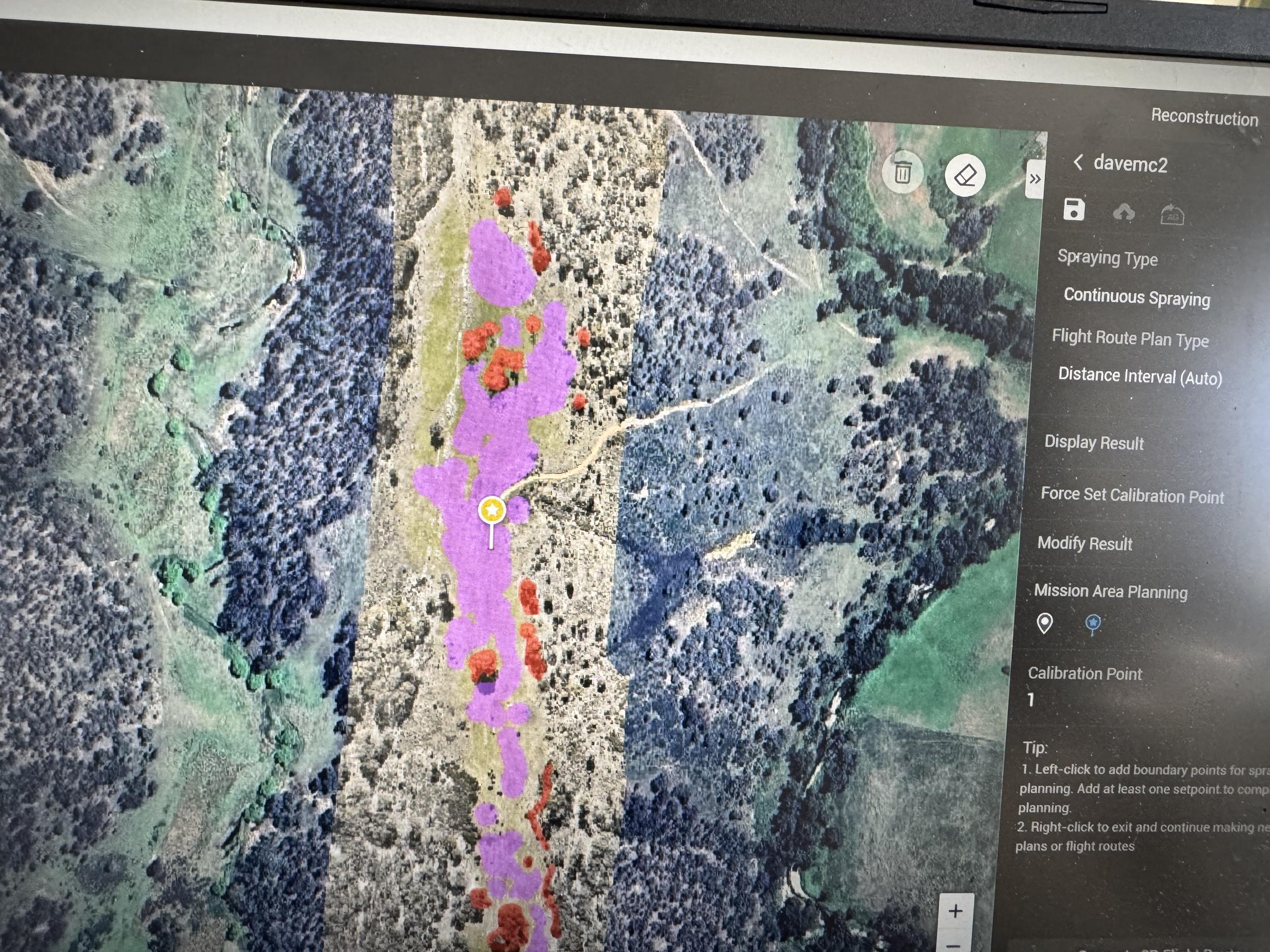
Our mapping and surveying service leverages advanced drone technology to provide detailed topographic maps and land surveys. Ideal for land developers, agricultural businesses, and environmentalists, our aerial surveys deliver precise data for planning and decision-making. Drones can capture high-resolution images and 3D models of the terrain, enabling accurate evaluations of land use and resource management. Our team ensures that you receive comprehensive reports and visualizations to support your projects, whether it involves land development, agricultural planning, or environmental monitoring. Experience the benefits of efficient and precise mapping solutions tailored to your needs.